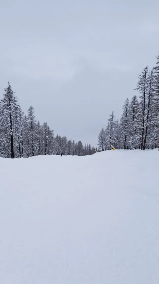
Montgenèvre
 Cervières, Hautes-Alpes$$
About this mountain
Montgenèvre sits on the Franco-Italian border at the Col de Montgenèvre, a pass with a documented history of transit stretching back to Roman times. The resort itself has strong claims to being one of the oldest organized ski areas in France, with competitive skiing recorded there in the early twentieth century. It developed steadily through the postwar decades and today forms part of the Voie Lactée (Milky Way) ski area, which links French and Italian resorts including Claviere, Cesana, Sestriere, and Sauze d'Oulx across the border. That cross-border connection gives Montgenèvre a reach well beyond its own 62 kilometres of pistes and is a significant part of its appeal to intermediate skiers looking for variety across a week.
The mountain's 2,579 feet of vertical drop, spread between a base of 5,889 feet and a summit of 8,468 feet, suits confident intermediates most comfortably, though beginners are well served by the lower slopes around the village. The terrain divides broadly into two sectors on either side of the col, with the Chalvet sector to the north and the Borgata and Gondrans areas to the south offering open, sun-exposed runs. Average annual snowfall of around 240 inches is solid for the elevation. The village itself sits directly at the pass, meaning ski-in access is genuine rather than aspirational, and the Italian border is skiable rather than merely symbolic.
Rankings
Where Montgenèvre places by community score.
Conditions
Recent snowfall
Storm tracker0.1" in the last seven days
Nov 1
Nov 2
Nov 3
Nov 4
Nov 5
Nov 6
Nov 7
Snow reliability
From 20 seasons of snowfall history, matched to the published annual average
Reliability
64/100 · Fairly reliable
More reliable than 67% of mountains
Best weeks
Nov 1–21
Mid-season dry spellThe share of past seasons with a stretch of 14 days or more in a row with no real new snow (under 1 cm, about half an inch, a day), in the heart of the season: mid-December to mid-March (mid-June to mid-September in the Southern Hemisphere).
70% of years
Fewer dry spells than 18% of mountains
Chance of a 6"+ day, by week
Tap a weekHover a week
Powder quality
How often the snow falls light and dry, from 20 seasons of hourly weather
Light and dry
81%
of its snow falls below 28°F
Region rank
#57 in the Alps
of 492 mountains
Country rank
#10 in France
of 131 mountains
Snow by type
Cold smoke39%
Under 20°F
Dry42%
20–28°F
Dense17%
28–32°F
Wet2%
Over 32°F
Light and dry, compared
Mountain
Vertical drop
2,579 ft
Base elevation
5,889 ft
Peak elevation
8,468 ft
Total lifts
24
Annual snowfall
240"
Total trails
83
Pistes
39 mi
Terrain parks
–
Sun & shade
Mostly southeast-facing: sunny and warmer. Snow softens early and gets heavy by afternoon in March.
Which runs are sunny, hour by hour →Trail breakdown
All lifts & trailsTrail and lift data from OpenSkiData / OpenSkiMap.org, © OpenStreetMap contributors (ODbL), Skimap.org, Who’s On First, © Mapterhorn.
Mountain DNA
Compare this mountain →How Montgenèvre ranks on each trait against every mountain on Slope Vaults. Dashed line: the median mountain.
Known for size and snow. Closest match: Orcières Merlette (91% alike).
- Size
- Vertical
- Snow
- Reliability
- Steeps
- Cruisers
- Value
Reviews
What users say
No reviews yet
Be the first to say what it’s like.
Nearby
Getting there
The closest major airport is Turin Caselle (TRN) in Italy, roughly 90 minutes' drive away, making it the most practical choice for most visitors. Grenoble (GNB) is approximately two hours away and handles significant winter charter traffic, while Lyon Saint-Exupéry (LYS) is around three hours. The main road approach is the D994t from Briançon, a straightforward 12 km climb that can be affected by snow or ice but is generally kept open with winter tyres or chains. The Col de Montgenèvre itself occasionally closes during heavy snowfall.
Briançon, 12 km west, is the main town where most visitors base themselves, offering a wider range of accommodation and services. Regular bus connections link Briançon to Montgenèvre throughout the ski season. Some visitors also cross from Claviere or Cesana Torinese on the Italian side, making the resort easily accessible from both countries.
While you’re there
Montgenèvre village sits at the base of the slopes and has a handful of restaurants and bars catering to the après crowd, with places along the main street serving Savoyard staples like fondue and raclette alongside straightforward mountain lunches. The resort connects into the Voie Lactée ski area shared with Italian resorts across the border, which adds some variety to evenings, it's easy enough to drive or take a shuttle through the Fréjus tunnel for dinner in Claviere or Sestriere. Off the slopes, the area around Montgenèvre and nearby Briançon offers snowshoeing trails, cross-country skiing loops, and a UNESCO-listed Vauban citadel in Briançon worth an afternoon visit.
Mountains like this
Matched on size, snow, terrain and more