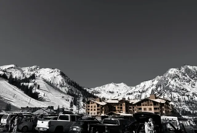
Soda Springs
 Soda Springs, California$$
About this mountain
Soda Springs opened in 1937, making it one of the oldest ski resorts in the Sierra Nevada and among the earliest in California. Located along Interstate 80 near Donner Pass, it built a reputation over the decades as a straightforward, unpretentious destination that prioritizes accessibility over ambition. The resort has long been associated with family skiing and beginner instruction, and its Planet Kids tubing and terrain park area has become a signature feature, drawing visitors who may not ski at all. Its proximity to the Bay Area and Sacramento, combined with modest lift ticket prices relative to neighboring resorts, has kept it a consistent local fixture rather than a destination draw.
The mountain offers 200 skiable acres across a 652-foot vertical drop, with a base elevation of 6,700 feet and a summit of 7,352 feet. The longest run stretches 0.6 miles, and three lifts serve the terrain. The layout suits beginners and lower-intermediates most comfortably, with wide, approachable runs that rarely challenge experienced skiers looking for steeps or technical terrain. Average annual snowfall of around 400 inches means the mountain is generally well-covered through the season. Access directly from Interstate 80 keeps logistics simple, and the small village area has a relaxed, no-frills character consistent with the resort's overall tone.
Rankings
Where Soda Springs places by community score.
Read: Best Resorts in USA →Conditions
Snow reliability
From 20 seasons of snowfall history, matched to the published annual average
Reliability
78/100 · Reliable
More reliable than 88% of mountains
Best weeks
Dec 6–26
Mid-season dry spellThe share of past seasons with a stretch of 14 days or more in a row with no real new snow (under 1 cm, about half an inch, a day), in the heart of the season: mid-December to mid-March (mid-June to mid-September in the Southern Hemisphere).
65% of years
Fewer dry spells than 23% of mountains
Chance of a 6"+ day, by week
Tap a weekHover a week
Powder quality
How often the snow falls light and dry, from 20 seasons of hourly weather
Light and dry
52%
of its snow falls below 28°F
Region rank
#19 in the Sierra Nevada
of 25 mountains
State rank
#19 in California
of 27 mountains
Snow by type
Cold smoke9%
Under 20°F
Dry43%
20–28°F
Dense38%
28–32°F
Wet10%
Over 32°F
Light and dry, compared
Mountain
Vertical drop
652 ft
Base elevation
6,700 ft
Peak elevation
7,352 ft
Size (acres)
200
Total lifts
3
Longest run
0.6 mi
Annual snowfall
400"
Total trails
15
Terrain parks
0
Sun & shade
Mostly northeast-facing: holds snow well, cold in January.
Which runs are sunny, hour by hour →Mountain DNA
Compare this mountain →How Soda Springs ranks on each trait against every mountain on Slope Vaults. Dashed line: the median mountain.
Known for snow and reliability. Closest match: Woodward Park City (79% alike).
- Size
- Vertical
- Snow
- Reliability
- Steeps
- Cruisers
- Value
Reviews
What users say
No reviews yet
Be the first to say what it’s like.
Nearby
Getting there
The closest major airport is Sacramento International Airport (SMF), roughly 90 miles southwest, translating to about a 1.5–2 hour drive depending on conditions. Reno-Tahoe International Airport (RNO) sits approximately 45 miles to the east and offers a drive of around an hour under normal conditions, making it a practical alternative for travelers coming from that direction.
Soda Springs is accessed via Interstate 80, one of the main trans-Sierra corridors. The highway is well-maintained but subject to chain controls and occasional closures during heavy storms, so checking Caltrans road conditions before departure is advisable. No dedicated shuttle service to Soda Springs is widely established. Most visitors base themselves in nearby Truckee, roughly 10 miles east, or in the broader Lake Tahoe area.
While you’re there
Soda Springs sits along Interstate 80 in the Sierra Nevada, making the nearby town of Truckee, about 10 miles west, the practical hub for dining and nightlife after a day on the hill. Truckee's commercial strip and downtown historic district offer a solid range of restaurants, craft breweries, and casual bars suited to families and groups finishing up a mountain day. The mountain itself keeps things simple, with a lodge offering basic food and warming space rather than an elaborate on-site dining scene.
Beyond skiing, the Soda Springs area has longstanding appeal for tubing through its Tube Town operation, which runs alongside the ski area. The surrounding national forest provides snowshoeing terrain, and Lake Tahoe's broader resort corridor, including Truckee, is within easy reach for skating rinks, sledding hills, and winter recreation of most kinds.
Mountains like this
Matched on size, snow, terrain and more